task:
Study on the development of the area 'Nördliche Rheinstrasse' in Darmstadt
client:
City of Science Darmstadt, Urban Planning Office
procedure type:
study, direct commission, 2021
site:
> 50.000 sqm
cooperation:
Rosanna Just-Calisir
visualization:
luxfeld digital art, Darmstadt |
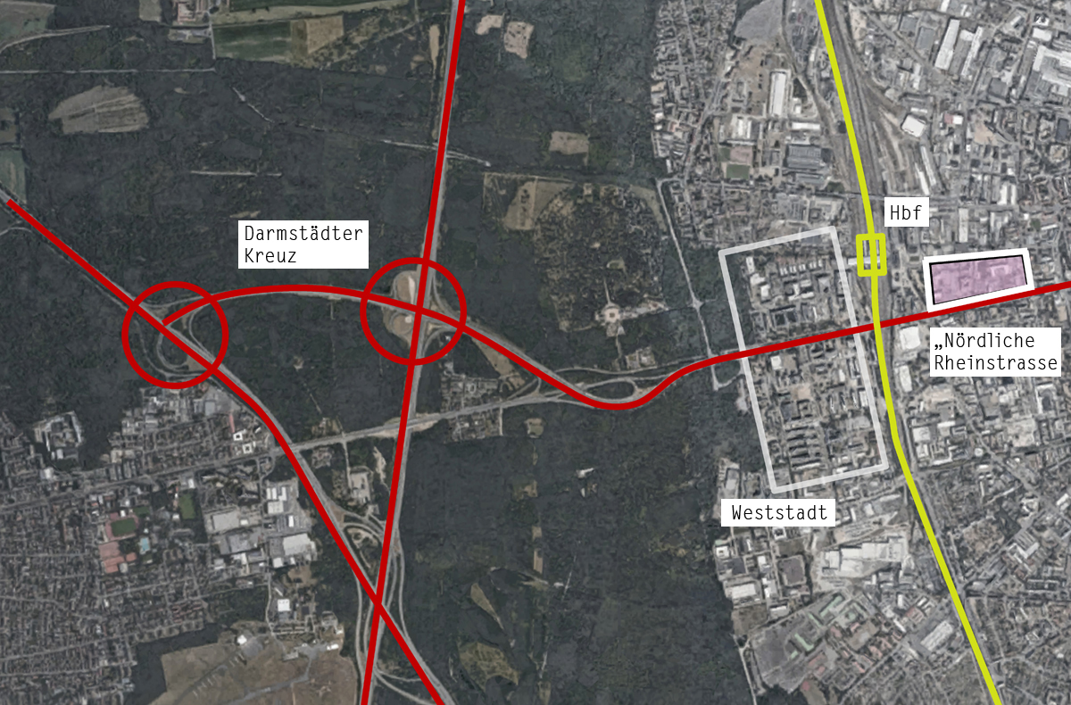
Darmstadt is connected to the surrounding area in all directions. However, the city is connected to the supra-regional transport networks primarily on its western side.
This is where the most important or most intensively used connections are located, such as the main railway station, which will be connected to the ICE line in the future, but also important motorway connections to the region.
Darmstadt also has the rare privilege that the edge of the urban soft landscape along this access route from the motorways is quite clear and free of sprawling and disorderly commercial areas, so that arriving travellers are presented with an orderly urban picture just a few hundred metres after leaving the motorway when they reach the Rheinstrasse axis or the ‘Weststadt’, which has been intensively developed in recent decades.
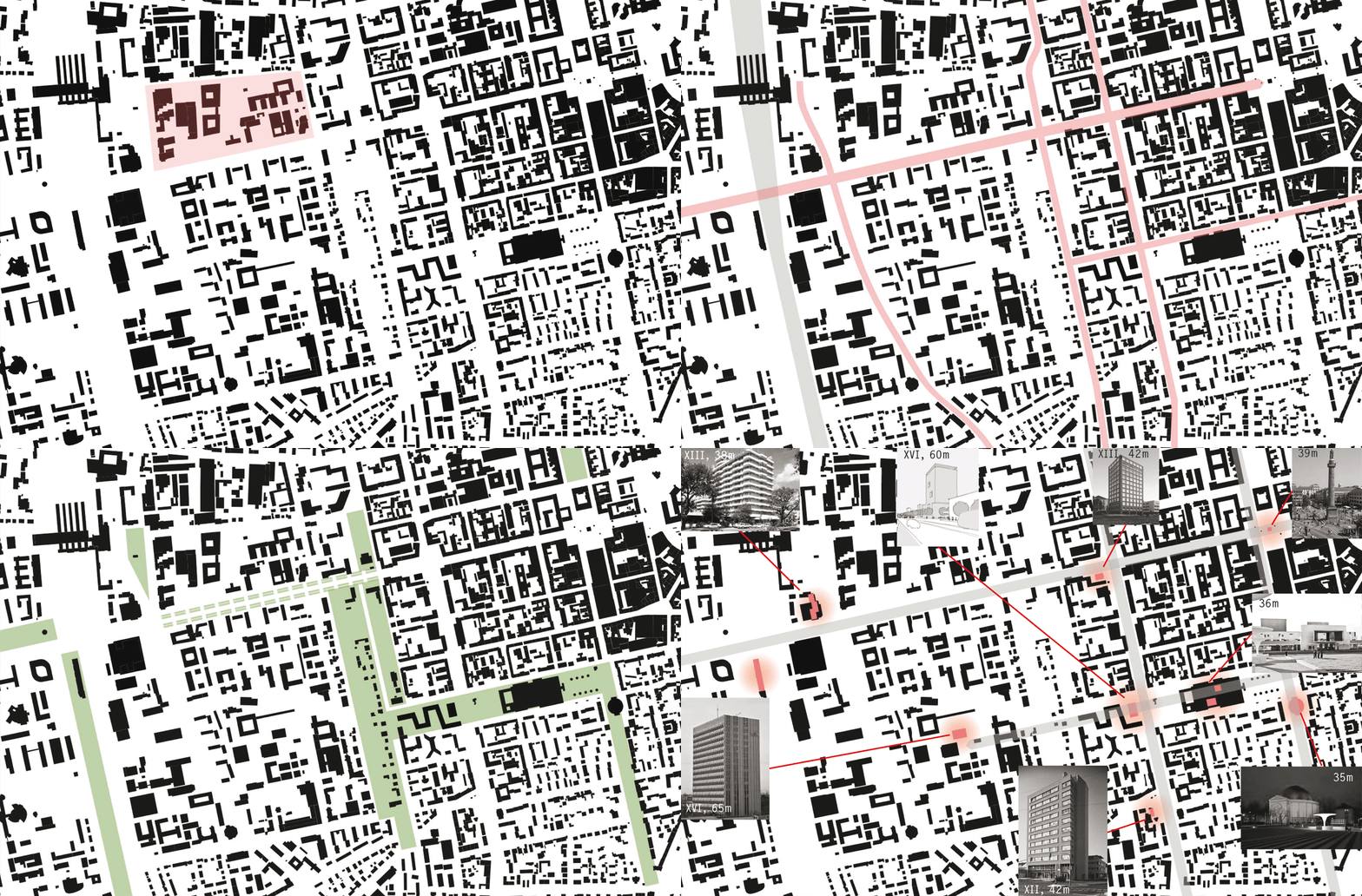
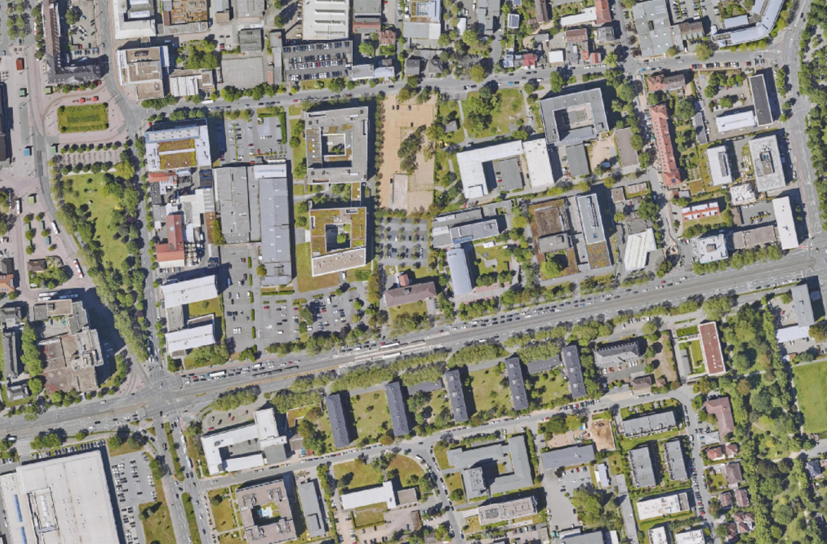
The south side of Rheinstrasse in the section between Goebelstrasse and Steubenplatz has a clearly legible and memorable order with its buildings from the early 1950s, albeit with a rather low density and height by today’s standards.
Other buildings, such as the ‘Haus der Wirtschaft Südhessen’ (House of Business South Hesse) or the new hotel building currently being planned, complement the order of buildings arranged perpendicular to Rheinstraße towards the east.
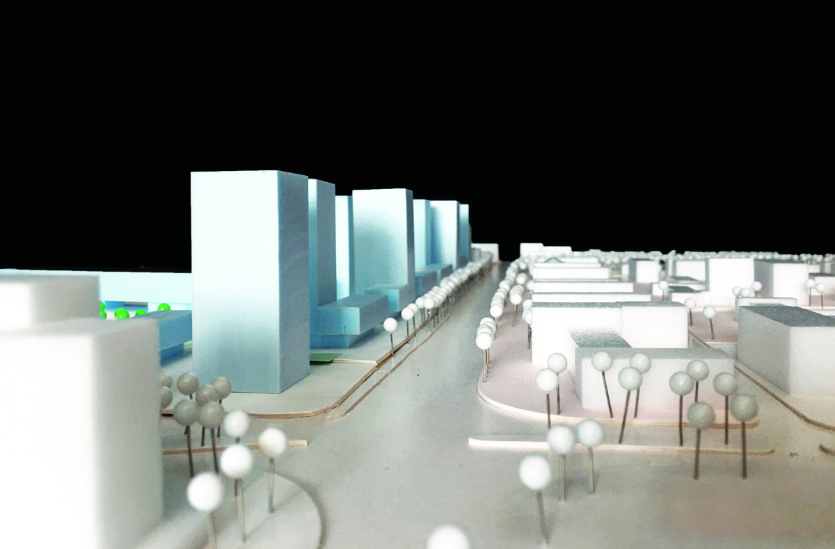
The north side of Rheinstraße in the same section, on the other hand, remains relatively unordered, faceless and lacking in presence.
The neighbourhood between Rheinstraße in the south, Mornewegstraße in the north, Feldbergstraße in the east and Goebelstraße and Platz der Deutschen Einheit in the west lacks both a programmatic positioning and an overarching urban planning idea.
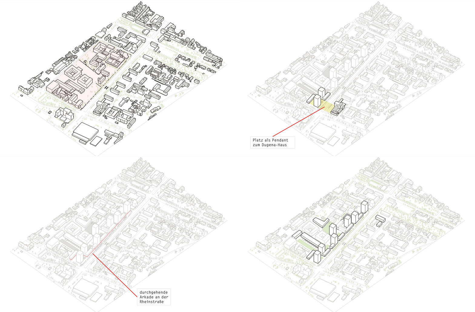
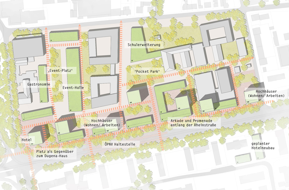
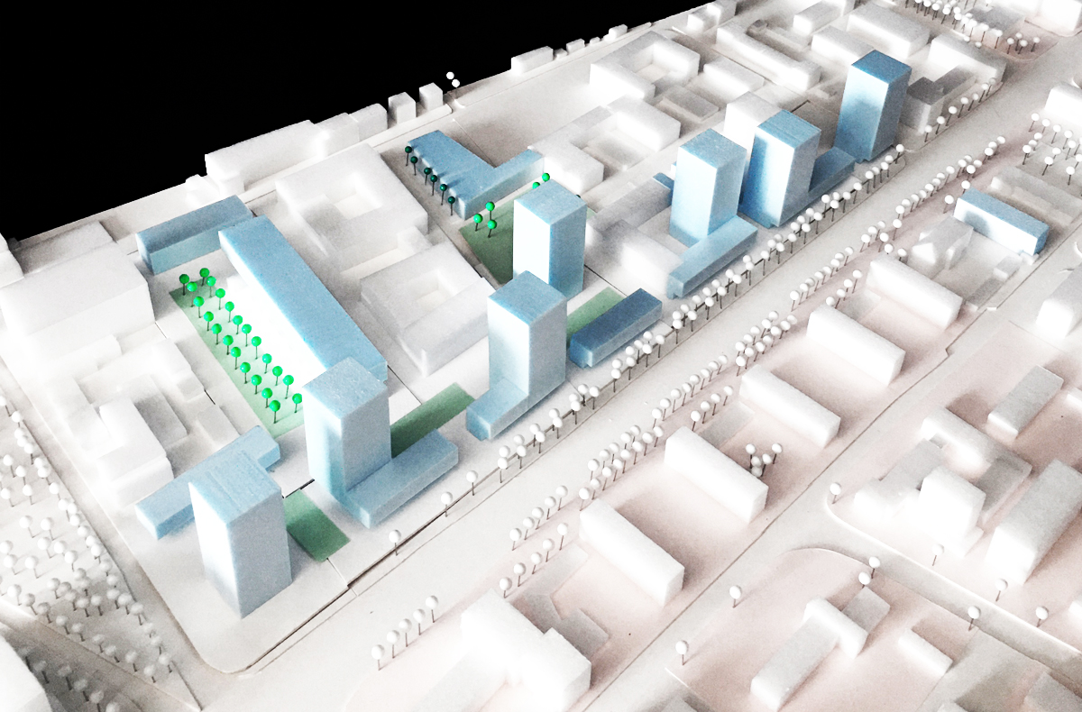
The study commissioned by the city planning department of Darmstadt intends to clarify the enormous potential that this area holds in its further development in an initial sketch and to make it vividly visible.
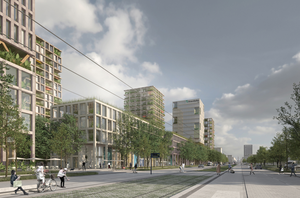
In view of its location and its development areas, this neighbourhood in particular offers ideal conditions for intensive internal development as a ‘green science quarter’, in which structures of sustainable living and working can be created in a future-oriented mix and density.
The immediate proximity to the rail and motorway networks takes into account the intensive supra-regional source and destination traffic of internationally active institutions and companies, without the inner city experiencing additional traffic congestion.
The proximity to the city centre in conjunction with the intensive public transport network makes it possible to live and work without having to use one’s own car.
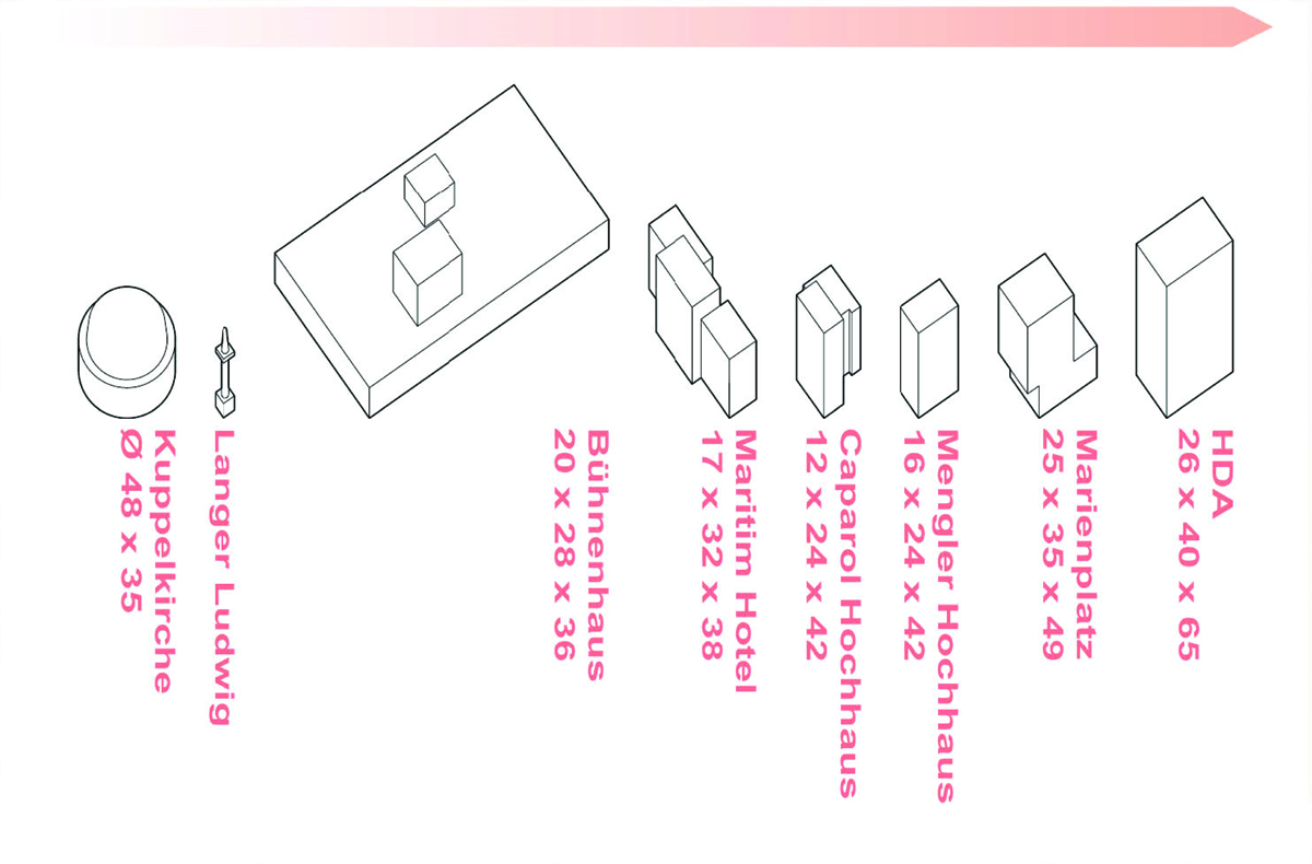
The location along the north side of the extensive Rheinstrasse makes it possible to arrange high-rise buildings without affecting existing residential quarters through shading and increased density of use.

