task:
planning of the subway station Schadowstrasse of the Wehrhahn Line in Düsseldorf
client:
State Capital Düsseldorf
procedure type:
competition 2001, invited, 1st prize
completion:
2016
artwork realization:
Ursula Damm (programming: Felix Bonowski, Berlin | sound: Yunchul Kim, Seoul, Korea)
pictures:
Jörg Hempel, Aachen
awards:
BDA Architecture Award, Nike for Atmosphere, 2019 | Halstenberg Commendation, Award of the German Academy for Urban Development and Regional Planning, 2018 | BDA Architecture Award NRW, Award, 2018 | Award for Good Buildings BDA Dusseldorf, Award, 2017 | CODAaward, Award, 2017 | Mies van der Rohe Award 2017, nomination | Preis des Deutschen Architektur Museum in Frankfurt, 2017, shortlist | Tunneling Award 2016, Finalist | World Architecture Festival 2016, Finalist | iconic awards 2016, Rat für Formgebung, winner |
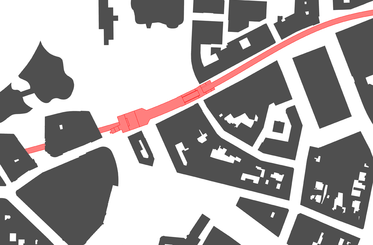
The Wehrhahn Line is a cooperation between architects, engineers, artists, and the city’s administration and represents the culmination of a total of 15 years planning and construction work in Düsseldorf. The 3,4 kilometer long new section of tunnel with six stations runs under downtown Düsseldorf and shows in it’s unique concept how architecture and art can be inextricably linked.
Space
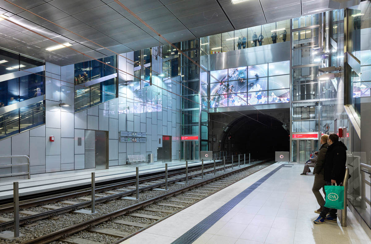
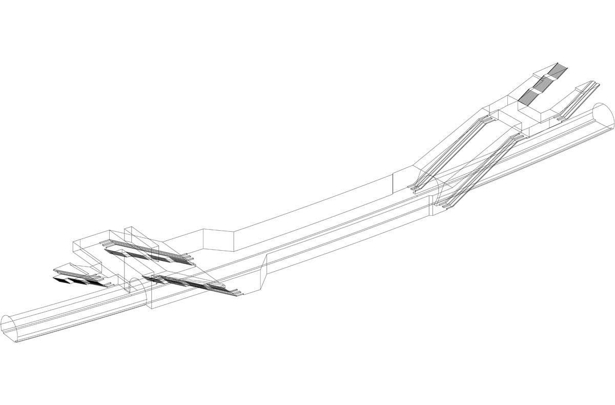
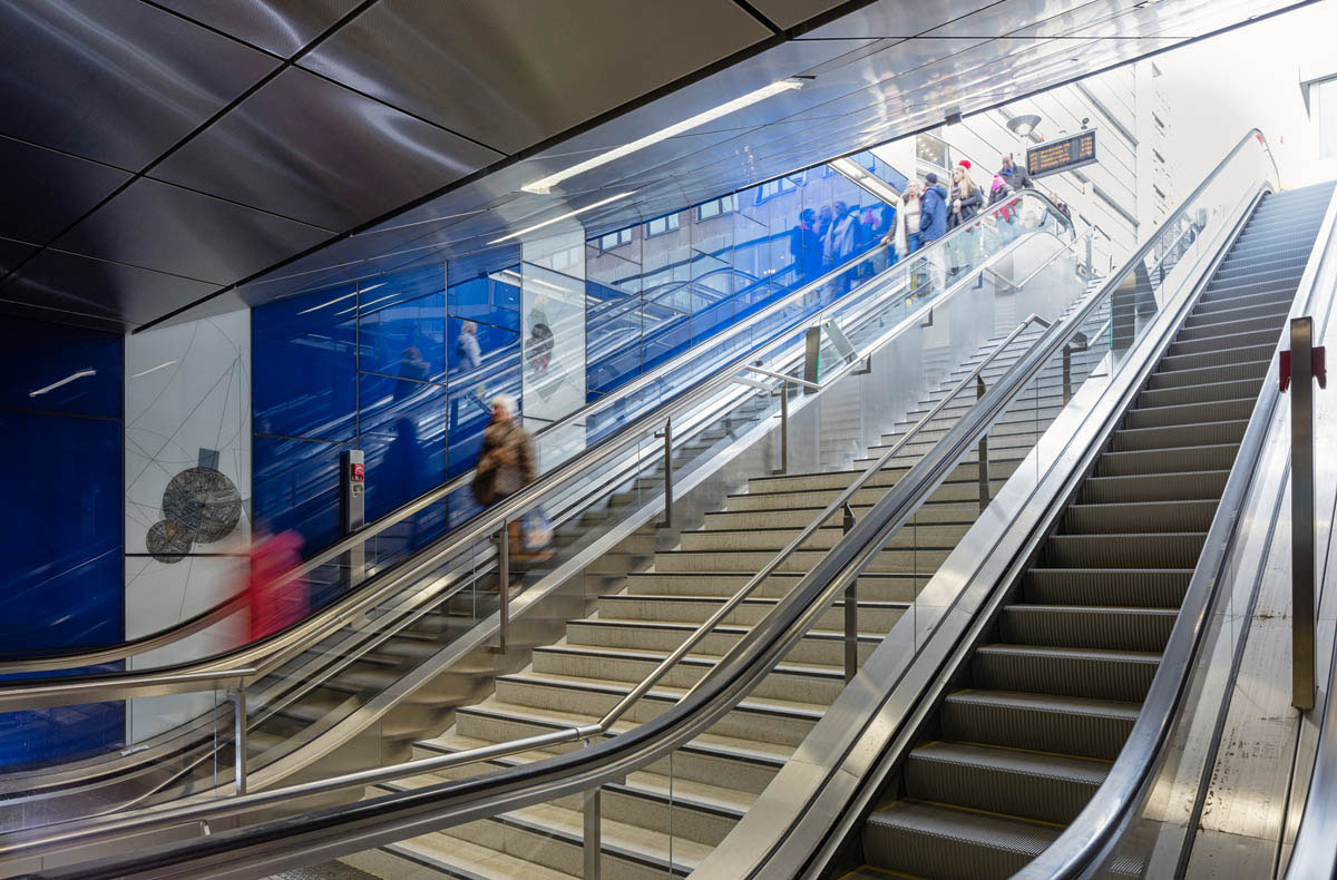
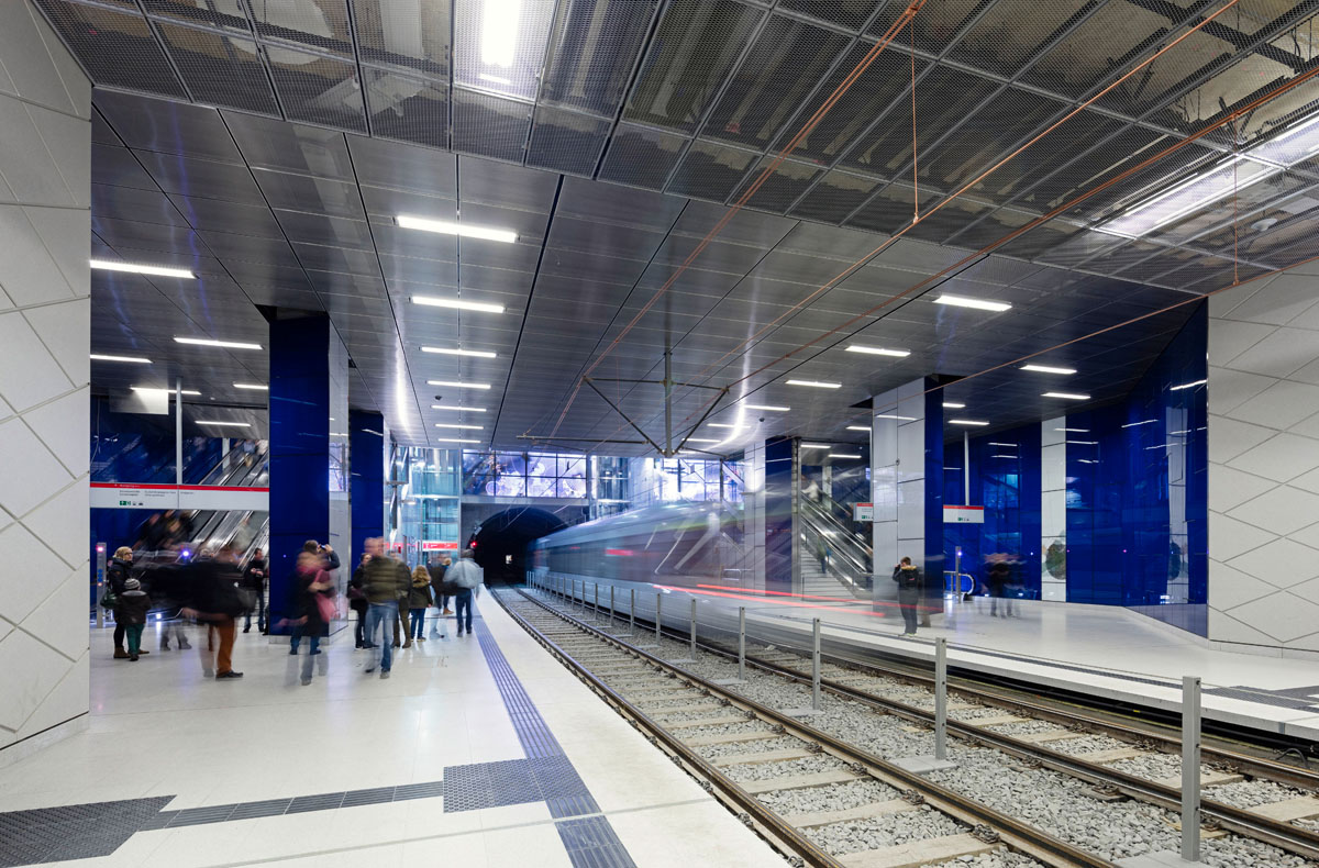
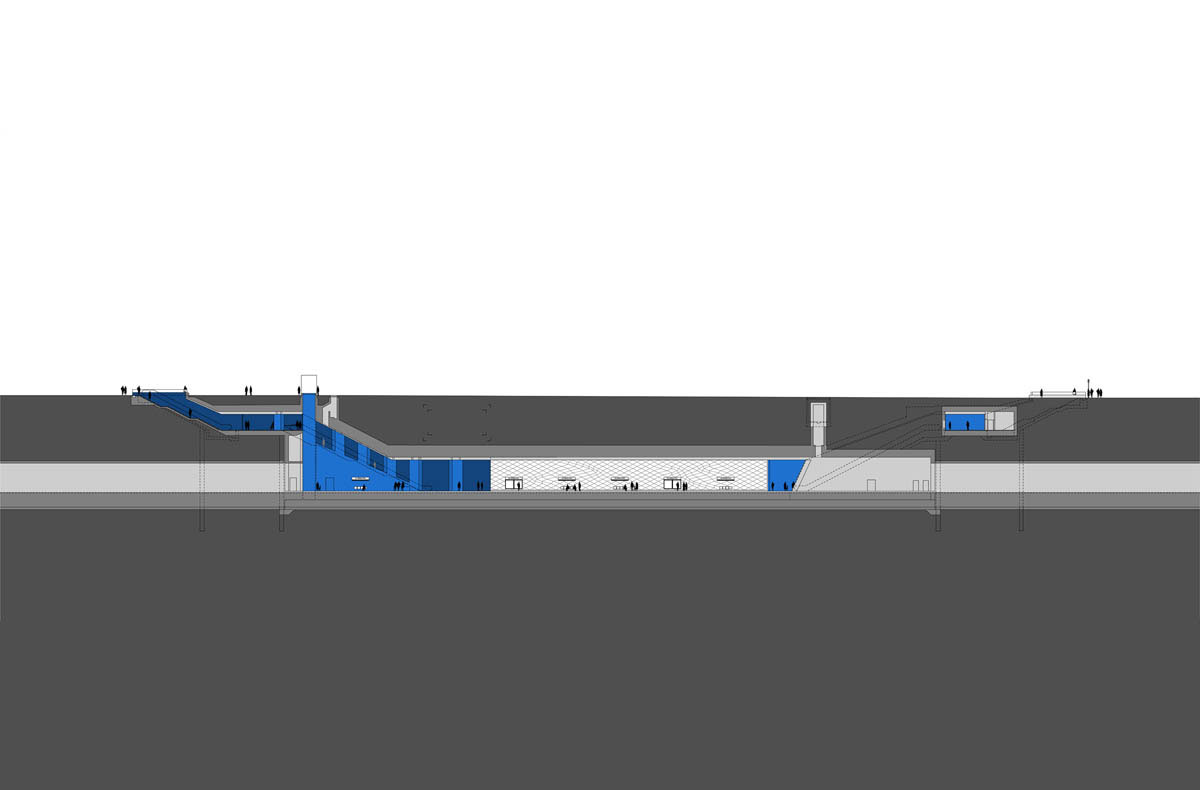
Passengers approach the west end of the station on Jan Wellem Platz via a short, wide entrance point connected to the upper concourse. The entrance is located in a cut that widens out like a funnel towards the platform level below, affording passengers clear views of the concourses. Two glass elevators serving the ground level are located between the staircases that are positioned on either side. In addition, a large skylight integrated into ground-level benches located between the elevators brings natural light down as far as the platform level. At its east end, the route leading to the exits at Schadowstrasse/Bleichstrasse and Schadowstrasse/Wagnerstrasse are extremely narrow due to construction constraints, the entrances are positioned in parallel at the street level and snuggle up to the tunnel. Here the platform terminates in front of escalators, which lead up to the concourse from the platform level; there are no staircases. Walls on both sides frame the entrances, and the ceiling is slightly splayed to provide better visibility. Here the cut interrupts breaks the Continuum and with its material qualities defines the area at platform level.
Turnstile
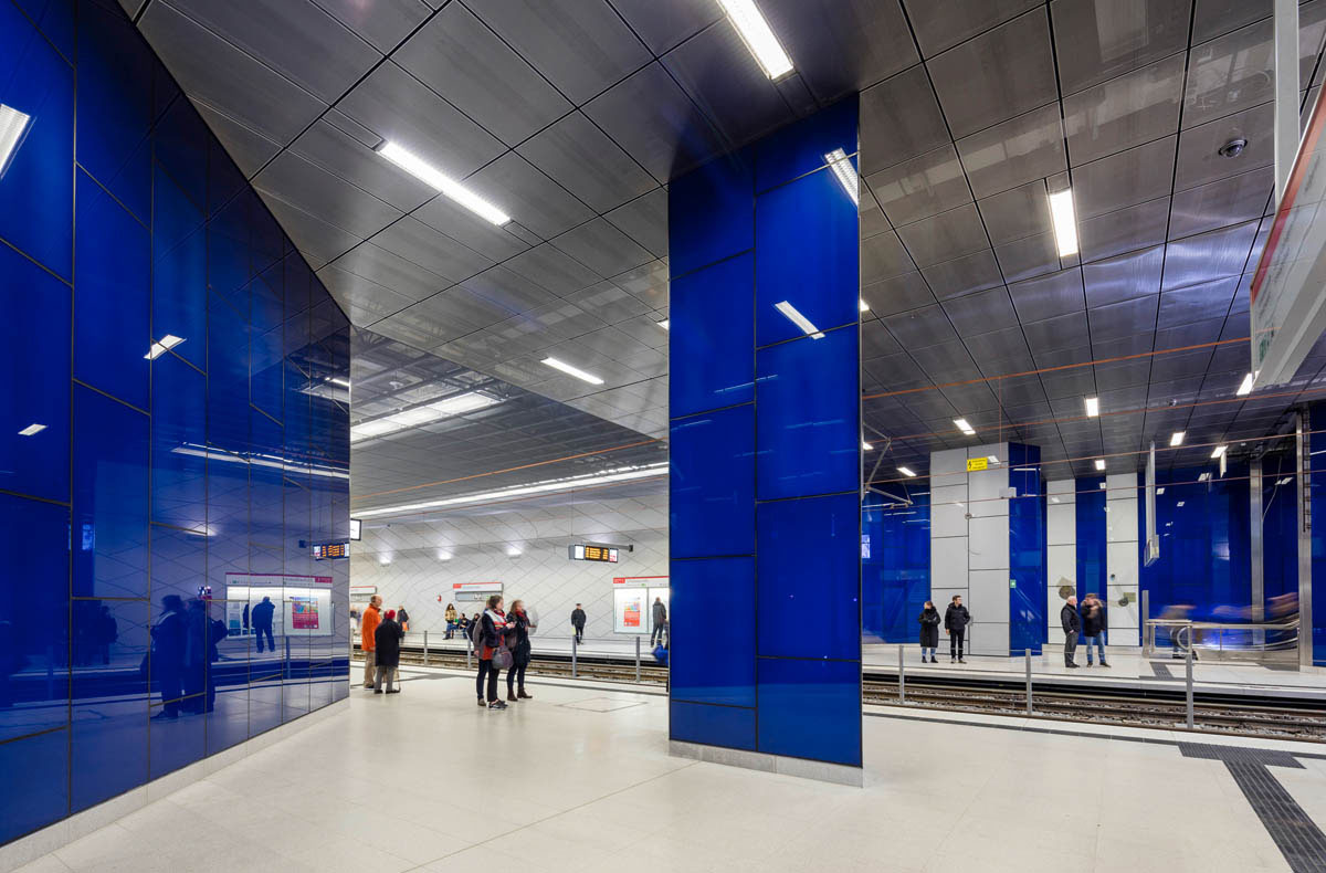
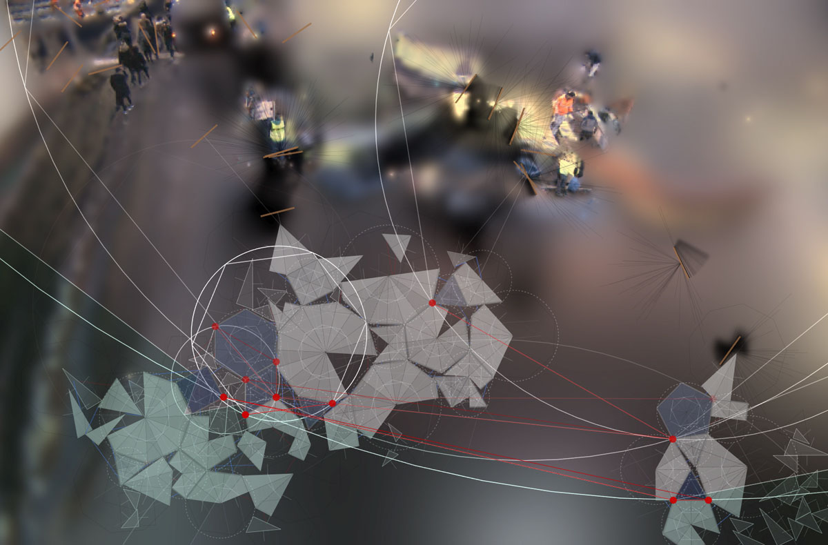
Ursula Damm has created an interactive installation involving multiple elements. At its center is a large LED screen displaying the real-time movements of passersby on the city surface – transformed through a computer program. The resulting images of small, virtual life forms are created by means of the constantly changing dynamic energy of the passersby. This concept recurs in the blue glass of the station’s walls. Geometrically interpreted aerial views of Düsseldorf are presented as a whole or excerpts.
Process and Construction
The central projection surface is integrated into the large front wall of the station. Here, reactive digital video is generated in real time. A video camera records the movements of aboveground passersby. These are then inputted into a specially developed software and treated as “energy sources” or virtual food. Small virtual creatures build a temporary, fluctuating architecture from the kinetic energy that emerges and vanishes with the daily rhythms of passersby. In order to keep this system running, it has at its disposal a global energy balance, an environment consisting of (simulated) physical parameters, which keep its metabolism (information processing) at work and by means of evolutionary processes in turn influence the nature of these “creatures”.
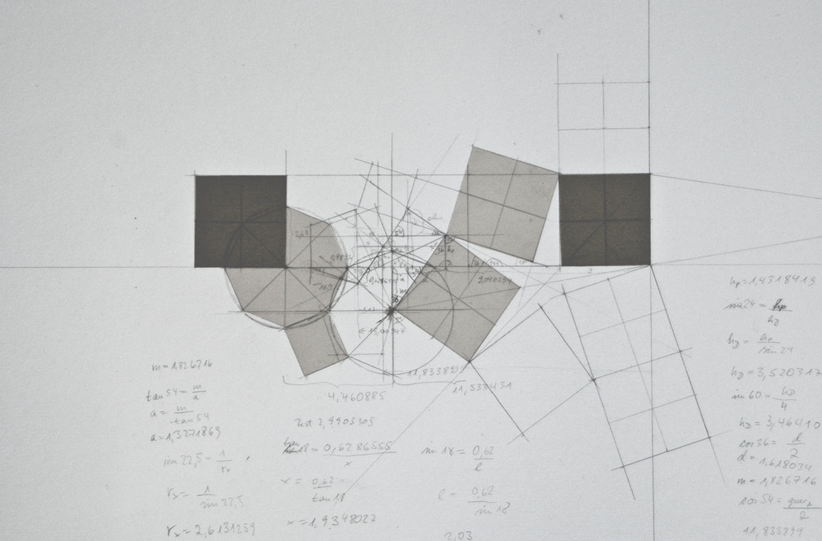
In the blue glass panels of the subway station individual, room-high panels have been installed at suitable locations, where they show the districts of Düsseldorf like a sprinkle of geometries. First of all a line drawing was prepared of the cityscape. The intention being to highlight important pedestrians axes and traffic flow. The areas enclosed by the axes were then transformed into polygons and the angles of lines and axes calculated as integer fractions of regular polygons. The smallest polygon, which integrates all of the symmetries of the location, is then used to describe the intersection. In a further step the connections (network) between the large polygons of a neighborhood are defined.
The Wehrhahn Line is a cooperation between architects, engineers, artists, and the city’s administration and represents the culmination of a total of 15 years planning and construction work in Düsseldorf. The 3,4 kilometer long new section of tunnel with six stations runs under downtown Düsseldorf and shows in it’s unique concept how architecture and art can be inextricably linked.
Space
Passengers approach the west end of the station on Jan Wellem Platz via a short, wide entrance point connected to the upper concourse. The entrance is located in a cut that widens out like a funnel towards the platform level below, affording passengers clear views of the concourses. Two glass elevators serving the ground level are located between the staircases that are positioned on either side. In addition, a large skylight integrated into ground-level benches located between the elevators brings natural light down as far as the platform level. At its east end, the route leading to the exits at Schadowstrasse/Bleichstrasse and Schadowstrasse/Wagnerstrasse are extremely narrow due to construction constraints, the entrances are positioned in parallel at the street level and snuggle up to the tunnel. Here the platform terminates in front of escalators, which lead up to the concourse from the platform level; there are no staircases. Walls on both sides frame the entrances, and the ceiling is slightly splayed to provide better visibility. Here the cut interrupts breaks the Continuum and with its material qualities defines the area at platform level.
Turnstile
Ursula Damm has created an interactive installation involving multiple elements. At its center is a large LED screen displaying the real-time movements of passersby on the city surface – transformed through a computer program. The resulting images of small, virtual life forms are created by means of the constantly changing dynamic energy of the passersby. This concept recurs in the blue glass of the station’s walls. Geometrically interpreted aerial views of Düsseldorf are presented as a whole or excerpts.
Process and Construction
The central projection surface is integrated into the large front wall of the station. Here, reactive digital video is generated in real time. A video camera records the movements of aboveground passersby. These are then inputted into a specially developed software and treated as “energy sources” or virtual food. Small virtual creatures build a temporary, fluctuating architecture from the kinetic energy that emerges and vanishes with the daily rhythms of passersby. In order to keep this system running, it has at its disposal a global energy balance, an environment consisting of (simulated) physical parameters, which keep its metabolism (information processing) at work and by means of evolutionary processes in turn influence the nature of these “creatures”.
In the blue glass panels of the subway station individual, room-high panels have been installed at suitable locations, where they show the districts of Düsseldorf like a sprinkle of geometries. First of all a line drawing was prepared of the cityscape. The intention being to highlight important pedestrians axes and traffic flow. The areas enclosed by the axes were then transformed into polygons and the angles of lines and axes calculated as integer fractions of regular polygons. The smallest polygon, which integrates all of the symmetries of the location, is then used to describe the intersection. In a further step the connections (network) between the large polygons of a neighborhood are defined.